Interactive Maps
What can we help you find?
Interactive maps help you locate facilities and amenities, business areas and vacant land within Markham's borders.
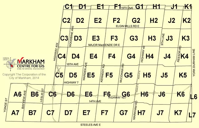
- Markham Street Guide
Both the maps and the Street Name Index are updated monthly (as required) by the Centre for GIS. Updates are published as PDF files. To view an individual map, click on the desired Concession map link below the image.

Concession Maps [PDF]
- Navigate Markham Map
Use Navigate Markham to explore Markham or your neighbourhood and locate Markham facilities and amenities.
- Parks & Pathways Map
Use Markham Parks & Pathways Map to search for community information, such as parks, pathways, community centres, basketball courts, splashpads, fire stations, libraries and more.
- Roads Map
Use the Roads Map to locate current pavement projects, crossing guard sections, and traffic signals, identify road ownership - Markham, Toronto, York Region or Ontario Government, and review winter maintenance service levels and traffic volume levels.
- Vacant Land Map
Use Economic Development Vacant Land to search for business & commercial information, such as business areas, vacant land, commercial properties, and more.
- Ward Map
Use Markham Ward Map to identify your ward and councillor. Zoom in or out to locate your street and pan through the neighbourhood. Simply click on the ward number to contact your councillor.
